People travel from all over North America to play in a large-scale live action tactical game (milsim) at the Horseshoe Bend Ranch in Klickitat County, Washington (USA). People playing in this event have no detailed understanding of the site. Some need to play (move and fight) on the site as if it was home. We made a map to help players use the terrain as if it was home.
Here's an outline of what's ahead:
- Why map Horseshoe Bend Ranch?
- Useful features in the map
- Why did we modify the format?
- How did we modify the format?
- Using the map at Gate 7
- Seeing your weakness at Gate 3
- Knowing what to expect at Hill 307
- Where do you find the base data?
- Use QGIS to make a map
- What is Omega Ops?
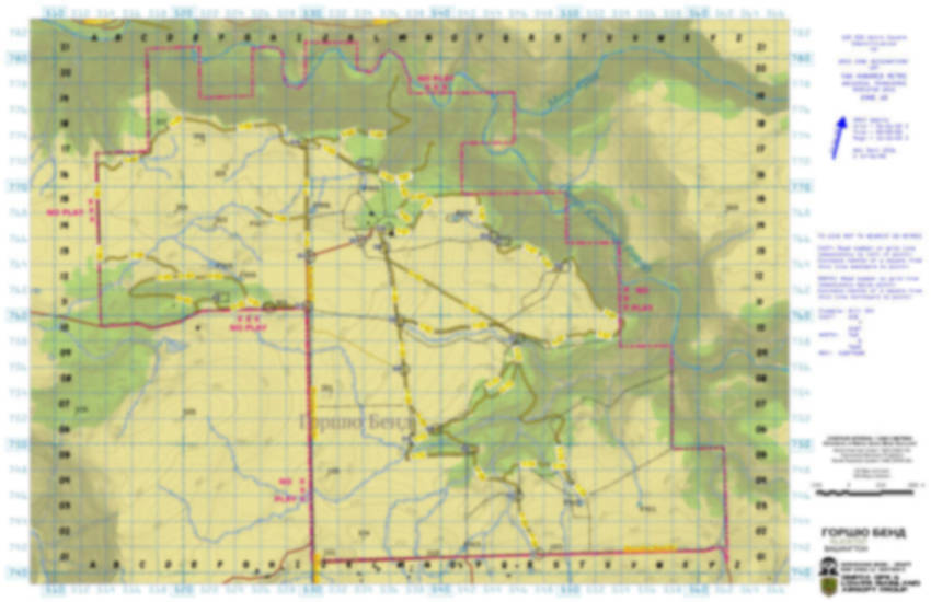
- Snapshots from the maps
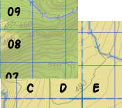
1. Why map Horseshoe Bend Ranch?
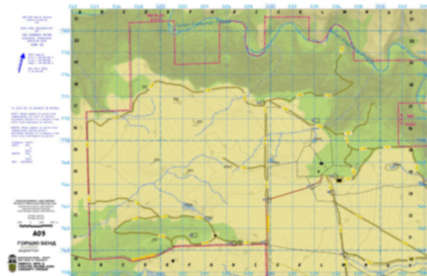
A company called Milsim West organizes large-scale live action tactical games, often known as military simulations (milsims), and rents the Horseshoe Bend Ranch as the field to play on. This particular event divides players into two factions: Red and Blue. From 2015 to 2017, event organizers issued a large-scale map with orthophoto for players to use to navigate the site and coordinate team play across the site. That map could not show useful terrain features.
For 2019, a small group of people from BC volunteered to lead one of the three units in one of the two factions. This group needed a map that showed terrain features missing from the official map.
This determined group, mostly people from Omega Ops, understood that a better knowledge of the terrain would improve team morale and boost its own enjoyment. Sharing detailed site knowledge could raise confidence in other players, too. This unit was playing the part of local militia fighters, which makes terrain knowledge an important way for players to contribute to the overall experience.
Doers get more enjoyment.
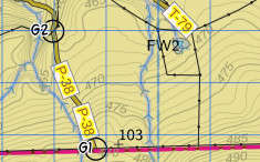
2. Useful features for the map
In addition to standard features on topographical maps, such as contours, creeks, forest cover, buildings, fences, streets and waterbodies, we included several features specific for this particular recreational use:
-
numeric grid coordinates that mimic local Military Grid Reference System and highlight the UTM 1000-metre coordinate grid
-
alphanumeric grid-square designators
-
3-digit numeric tags for hilltops that use the first digit to show rough geographic groupings of hills
-
alphanumeric tags for ponds and strategic locations that are distinct from the grid-square designators and each type of location
-
alphanumeric tags for gates and trails
- colours suitable for reading under red light to keep from being spotted at a distance, and allow people to preserve night vision in the dark
3. Why did we modify the format?
Usually, I have made maps that follow the formatting and colour palette you find on Canadian topographic maps or UK ordnance-survey maps.
For this map, the people using it will need to use it at night under red light and the scale is small enough that the entire map only spans a small number of squares from the 1000-metre UTM grid.
4. How did we modify the format?
We incorporated several modifications. We:
-
adjusted the background colour in the map settings under the layout manager to reduce bright reflections at night to limit attracting attention from adversaries
-
adjusted the other symbol and label colours to work with the dark off-white base colour and still read under red light to limit attracting attention from adversaries
-
used 200-metre grid and set a distinctive symbol for the UTM 1000-metre grid to improve ability to coordinate teams on site
-
created three smaller-scale maps suitable for arranging in a composite map without trimming any of the reference information from the margins and map frame to allow teams focused maps for specific areas on the site
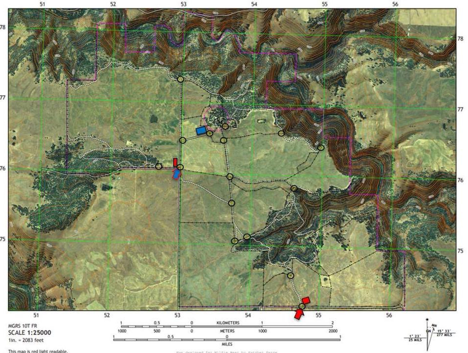
- generated contours suitable for our scale to reveal terrain detail to teams (standard interval is 20 ft, our interval is 1 m)
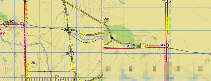
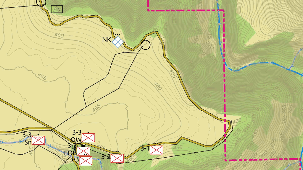
5. Using the map at Gate 7
Red's knob trap. 30 trained and motivated Blue to 22 Red motivated irregulars.
You can find a 100-metre wide knob in the open paddock northeast of Gate 7. On top of that knob, you can also find a slight knoll. Enough to hide a spotting team behind.
Red must hold Blue from advancing south past Gate 7 to allow time for reinforcements to arrive. Blue infantry approach along the road entering the paddock from the northwest.
Blue turns to leave the fence and shortcut cross-country to reach Gate 7.
Two observer teams see Blue approach. A sniper team in the gully at 51447584 and an observer team at 54697584.
Red 3-1, 3-2, 3-3 have hidden defensive positions along the south edge of the road that follows the south edge of the paddock. Lying in wait for the Blue. Red 3-1 observes the Blue unit at the same time as the spotters do. A patrol moves northeast to monitor Blue as it passes behind the knob.
Red 3-3 moves to the fence at 51467591 to delay Blue in a feint. Blue advances strong along the fence to attack.
3-3, observer and sniper drop back to the FOB point to regroup as 3-2 and 3-3 move to flank Blue. Blue seems to only notice 3-3.
3-1 rounds the knob and pins Blue to the road fence as 3-2 attacks from the gully. Red destroys Blue at 51507588.
6. Seeing your weakness at Gate 3
Blue has located Red headquarters at 54237956 and sent units to surround and eliminate it. Red 1 and 2 defend the south and east sectors. Red 3 defends the north sector.
100 Blue approach from the north and 100 Blue approach from the southeast, bearing down on approximately 90 Red.
Red 3 needs to lure Blue to an ambush on Gate 4 on a day with strong winds from the northwest. In this position, Red is able to stay hidden from Blue and keep other Red units in sight. 100 Blue to 26 Red.
Blue infantry and vehicle approach along the road north of the road triangle and can pick between Gate 3 and Gate 4. The HMMV turns towards Gate 3 while the infantry spread out into a line across the paddock. Red 3 gets ready to pounce from the ravine.
Red 3 realizes that it needs another squad to send west and ambush the HMMV from a network of swales carved into the landscape. Otherwise, it will need to fall back.

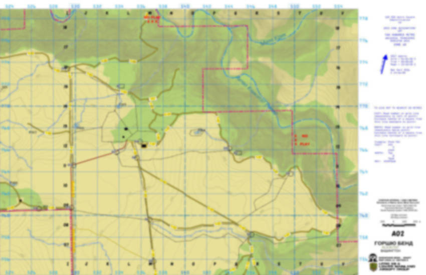
7. Knowing what to expect at Hill 307
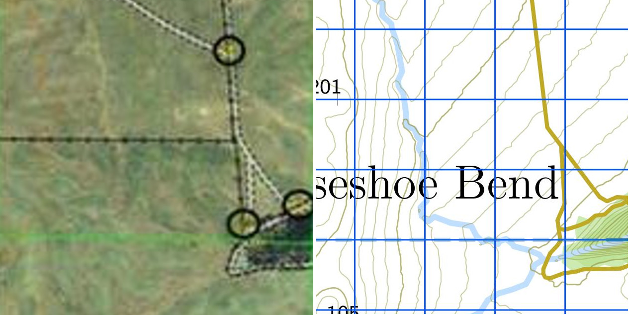
In the far northwest corner of the playing field, you will find a bend in the road that goes around the site. You find a nice knoll in the forest on the new map.
One night, Red 3 patrolled west on the loop road and rounded the turn at 51957754 and encountered an ambush waiting on the forest edge. Red 3 soon learned that, behind the knoll, a large Blue force was camped out resting. In short order, Red 3 had awakened the Gorilla and lost the battle to Blue.
You can see the 12-foot high knoll on a map with one-metre contours. You miss the knoll on a map with 20-foot contours.
8. Where do you find the base data?
This map uses open data from US government sources. The ranch site is in Klickitat County, Washington. Klickitat County maintains an online map and you can download map and other data from the United States Geological Service.
Data sources:
-
base mapping data - United States Geological Survey, shape data for Centerville and Wahkiacus quadrangles
-
ground model - United States Geological Survey, national elevation data for Dalles, Oregon
-
property mapping data - Klickitat County
-
waterways - USGS, National Hydrographic Data
-
detailed site and land cover data - interpreted from USGS orthophotos
- fences - georeferenced and interpreted from map image provided by event organizer, Milsim West
9. Use QGIS to make a map
QGIS, sometimes called Quantum GIS, is a free and open source tool for assembling and analyzing geographic information. You have likely heard of its proprietary commercial counterpart, ArcGIS.
You can use QGIS to make maps and interpret mapped information:
- Assemble downloaded open data with online data and your own data
- Create maps as images or PDF's
- Create interpreted geographic data for maps
- Georeference images to maps
- Analyze geographic images
- Analyze geographic data (points, shapes, lines, numbers)
10. What is Omega Ops?
Omega Ops is a small BC company that organizes live action tactical games for adults. To challenge adult players, these events involve higher intensity and complexity than brief skirmish games can offer. The members of the company also play together in large-scale live action tactical games, such as Milsim West's military simulations.
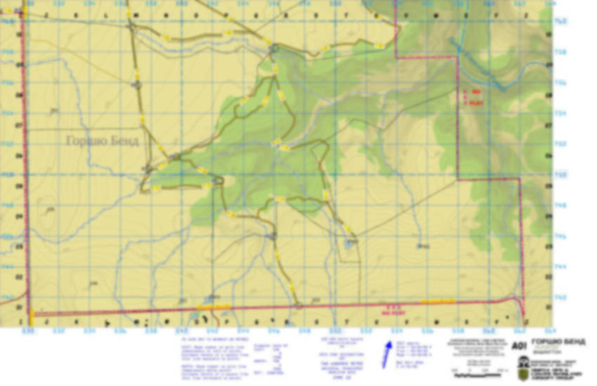
11. Snapshots from the maps
Join the Red team to learn more during the next Milsim West event.